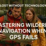
In a world where digital tools are often taken for granted, losing your GPS signal or breaking your smartphone can leave you vulnerable. Survival navigation is a forgotten art—but mastering it gives you freedom, self-reliance, and the ability to traverse wild terrain with confidence. Whether you’re bugging out, lost while hiking, or surviving a disaster, these techniques will help you move with direction and purpose.
The art of navigation predates civilization itself. Our ancestors crossed continents, navigated vast oceans, and explored uncharted territories using nothing but their understanding of natural patterns and celestial movements. Today, while we have the luxury of GPS technology, these fundamental skills remain as relevant as ever, perhaps more so in an age of increasing technological dependence.
Why Survival Navigation Matters More Than Ever
Navigation isn’t just about finding north—it’s about knowing how to reach safety, shelter, water, or your next supply point without wasting energy. Without navigation skills, you risk walking in circles, doubling back, or worse, heading straight into a natural hazard. A compass can fail. Batteries die. But your brain, your senses, and the environment never run out of charge.
Consider the increasing frequency of natural disasters, power grid failures, and communication breakdowns. Solar flares, electromagnetic pulses, or simple battery depletion can render electronic navigation useless in moments. Meanwhile, search and rescue statistics show that the majority of wilderness emergencies involve people who became disoriented or lost, often just miles from safety.
Modern reliance on GPS has created a generation of “learned helplessness” when it comes to spatial awareness. Studies show that people who rely heavily on turn-by-turn navigation develop weaker spatial memory and struggle more with basic orientation tasks. By developing natural navigation skills, you’re not just preparing for emergencies—you’re strengthening fundamental cognitive abilities that enhance your overall spatial intelligence.
“When technology fails, your brain, your eyes, and the sky become your compass.” — Bear Grylls, Adventurer & Survival Expert
Understanding Your Environment: The Foundation of Natural Navigation
Before diving into specific techniques, successful navigation requires developing environmental awareness. This means training yourself to notice and interpret the subtle signs that nature provides constantly. Weather patterns, vegetation growth, animal behavior, and geological features all contain directional information if you know how to read them.
Start by practicing in familiar areas. During your daily walks or hikes, consciously observe how shadows fall, which sides of buildings collect snow or stay dry, where moss grows most abundantly, and how the landscape changes throughout the day and seasons. This foundation of observation will serve you well when you need these skills in unfamiliar territory.
Using the Sun to Navigate: Beyond Basic East and West
The sun is a reliable indicator of direction and time, but its usefulness extends far beyond the simple “rises in the east, sets in the west” rule. In the Northern Hemisphere, it rises in the east and sets in the west, moving across the southern part of the sky. In the Southern Hemisphere, it moves north. However, these directions shift throughout the year due to Earth’s axial tilt.
During summer months in the Northern Hemisphere, the sun rises northeast and sets northwest, while in winter it rises southeast and sets southwest. Understanding these seasonal variations is crucial for accurate navigation. The sun reaches its highest point due south at solar noon, which rarely coincides with clock noon due to time zones and daylight saving time.
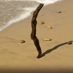
The Shadow Stick Method: Step-by-Step Precision
The shadow stick method is one of the most reliable solar navigation techniques. Choose a straight stick about three feet long and find level ground with good sun exposure. Place the stick vertically, ensuring it’s as straight as possible. Mark the tip of the shadow with a stone or scratch in the dirt.
Wait 15-30 minutes and mark the new shadow tip. The line connecting these points runs east-west, with the first mark indicating west and the second indicating east. For greater accuracy, repeat this process several times throughout the day. The shadow will be shortest at solar noon, pointing directly north in the Northern Hemisphere.
Reading Sun Angles Throughout the Day
The sun’s position relative to the horizon changes predictably throughout the day. At sunrise and sunset, it sits on the horizon. By mid-morning (around 9 AM), it’s roughly 45 degrees above the eastern horizon. At solar noon, it reaches its highest point, directly south in the Northern Hemisphere. Learning to estimate these angles helps you determine both direction and approximate time without a watch.
Finding North with the Stars: Your Celestial Compass
When the sun goes down, the stars become your guide. Unlike the sun, which moves across the sky daily, certain stars maintain relatively fixed positions, making them reliable navigational aids. Star navigation requires clear skies and some knowledge of key constellations, but it’s remarkably accurate once mastered.
Northern Hemisphere: Polaris and the Big Dipper
In the Northern Hemisphere, locate Polaris (the North Star) using the Big Dipper constellation. Find the Big Dipper’s “bowl” and identify the two stars farthest from the handle—these are called the “pointer stars.” Draw an imaginary line through these stars and extend it about five times the distance between them. This line points directly to Polaris, which sits almost exactly above true north.
Polaris appears stationary while other stars rotate around it throughout the night. This makes it invaluable for maintaining direction during night travel. The Big Dipper rotates around Polaris, so it may appear upside down or sideways depending on the time of year and night, but the pointer star method always works.
Southern Hemisphere: The Southern Cross
In the Southern Hemisphere, use the Southern Cross constellation. This distinctive cross-shaped pattern is smaller than many people expect. Find the Southern Cross and identify its two brightest stars, which form the long axis of the cross. Draw an imaginary line through these stars and extend it four and a half times the length of the cross itself to locate the south celestial pole.
Unlike the Northern Hemisphere’s bright Polaris, there’s no bright star marking the south. Instead, you’ll find a relatively dark area of sky. Drop a line straight down from this point to the horizon to find due south.
Using Orion for Direction
The constellation Orion is visible from both hemispheres and offers another navigation tool. Orion’s belt, three stars in a distinctive line, rises due east and sets due west regardless of your location on Earth. This makes Orion particularly useful for determining cardinal directions when other constellations aren’t visible or recognizable.

Landmarks and Terrain Association: Building Your Mental Map
One of the oldest navigation techniques is to associate your movement with fixed natural features. Mountains, ridgelines, river bends, or distinct tree clusters can act as reference points. This method, called terrain association, forms the backbone of military land navigation and remains highly effective for civilian use.
Develop a mental or sketched map as you travel. Start by identifying major terrain features visible from your starting point. As you move, continuously update your mental picture, noting how these features appear from different angles and distances. Pay special attention to “handrail” features like rivers, ridgelines, or valleys that can guide your movement, and “backstop” features like major highways or rivers that indicate when you’ve gone too far in one direction.
Creating and Using Waypoints
Waypoints are specific, identifiable locations that help you track progress and maintain direction. Choose distinctive features that are visible from multiple angles: a uniquely shaped rock formation, a dead tree with a distinctive shape, or the intersection of two streams. Space waypoints so you can see the next one from your current position when possible.
When selecting waypoints, consider how they’ll appear at different times of day and in different weather conditions. A shadow that helps identify a rock formation at noon might disappear by evening. A stream junction that’s clear in dry weather might be obscured by fog or snow.
Reading Nature’s Compass: Moss, Trees, and Environmental Clues
Natural clues like moss or snow melt patterns can help you infer direction, but they’re rarely 100% reliable alone. These indicators work best when used together and confirmed by other navigation methods. Understanding why these patterns occur helps you interpret them more accurately.
Moss and Lichen Patterns
In the Northern Hemisphere, moss tends to be more abundant on the north-facing side of trees because of reduced direct sunlight and higher moisture retention. However, this rule has many exceptions. In dense forests, moss may grow on all sides of trees due to uniform shade. Near water sources, moss growth follows moisture patterns rather than sun exposure. Use moss as one indicator among many, not as your primary compass.
Lichen, which differs from moss, also tends to be more abundant on north-facing surfaces in the Northern Hemisphere. Lichen grows more slowly than moss but is often more reliable as a directional indicator because it’s more sensitive to subtle environmental differences.
Tree Growth Patterns and Bark Characteristics
Trees exhibit several directional growth patterns. In open areas, branches often grow more extensively on the south side due to increased sunlight. Bark may be thicker, darker, or more deeply furrowed on the south-facing side. Pine trees sometimes develop more branches and fuller growth on their south sides.
However, these patterns can be overridden by local conditions like prevailing winds, nearby structures, or competition from other trees. Wind-shaped trees, called “flagged” trees, point away from prevailing winds and can indicate direction if you know the local wind patterns.
Snow and Ice Patterns
Snow lingers longer on north-facing slopes in the Northern Hemisphere because they receive less direct sunlight. Ice forms differently on north and south faces of rocks and trees. South-facing slopes often show earlier spring melting and different vegetation patterns due to increased sun exposure.
These patterns are most reliable in areas with significant elevation changes and clear seasonal variations. In flat terrain or areas with inconsistent weather patterns, snow and ice indicators become less dependable.
Advanced Shadow Techniques and Solar Navigation
Beyond the basic shadow stick method, several advanced solar techniques can improve your navigational accuracy. These methods require more time and observation but provide greater precision, especially important for long-distance travel.
The Equal Shadow Method
This technique uses the fact that shadows of equal length occur at equal times before and after solar noon. In the morning, mark your shadow stick’s tip. Later in the day, when the shadow reaches the same length, mark it again. The line between these marks runs east-west with greater accuracy than the basic shadow stick method.
Using Body Shadows for Quick Direction Finding
Your own body can serve as a shadow stick in a pinch. Stand upright and mark the tip of your shadow. The shadow points away from the sun, providing a quick directional reference. This method works best on level ground and during midday hours when shadows are most distinct.
Improvised Navigation Tools: Creating Compass Alternatives
When conventional tools aren’t available, you can create navigation aids from common materials. These improvised tools won’t match the accuracy of quality instruments, but can provide valuable directional information in survival situations.
The Needle Compass Method
Magnetizing a needle allows you to create a basic compass. Stroke a steel needle or razor blade with silk, wool, or your hair in one direction about 50 times to induce magnetism. The friction aligns the metal’s magnetic domains, creating a weak but functional magnet.
Float the magnetized needle on a leaf or piece of cork in still water. It will gradually align north-south along Earth’s magnetic field lines. This method isn’t precise and can be affected by nearby metal objects, but it provides a general bearing that you can confirm with other navigation techniques.
The Water Bowl Compass
Fill a non-metallic container with water and float a magnetized needle on a small piece of cork or leaf. Shield the container from wind to prevent water movement that could affect the needle’s alignment. This setup is more stable than floating the needle directly on the air surface tension.
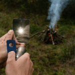
Creating a Sun Compass
You can create a simple sun compass using a straight stick and a flat surface. Place the stick vertically and mark shadow positions every hour throughout the day. This creates a rough clock face that shows both time and direction. The shortest shadow points north at solar noon.
Dead Reckoning and Pace Counting: Measuring Your Progress
Dead reckoning involves estimating your position based on time, direction, and pace. This technique becomes crucial in featureless terrain where landmarks are scarce or visibility is limited. Accurate dead reckoning requires knowing your walking pace and maintaining consistent direction.
Determining Your Pace Count
Begin by counting your steps over a known distance. Use a 100-meter course if possible, walking at your normal hiking pace. Count every time your left (or right) foot hits the ground. Repeat this several times and average the results. This gives you your “pace count” for 100 meters.
Practice pace counting on different terrains and slopes, as your pace will vary significantly between flat ground, uphill climbs, and downhill descents. Fatigue, pack weight, and weather conditions also affect pace, so recalibrate periodically during long journeys.
Maintaining Direction During Dead Reckoning
Choose intermediate targets along your intended route to prevent gradual drift off course. Pick an object in the distance along your bearing and walk toward it. Before reaching that object, select another target beyond it on the same bearing. This “leapfrogging” technique helps maintain straight-line travel.
In low-visibility conditions, use team navigation if possible. Send one person ahead to the limit of visibility, have them stop, and navigate toward them. This prevents the entire group from gradually veering off course due to individual navigation errors.
Weather Patterns and Wind Direction as Navigation Aids
Understanding local weather patterns can provide valuable directional information. Prevailing winds, cloud formations, and precipitation patterns often follow predictable directions based on geography and seasonal variations.
Reading Wind Patterns
Most regions have prevailing wind directions that remain consistent over time. Coastal areas experience onshore breezes during the day and offshore breezes at night. Mountain valleys create predictable wind patterns as air flows up and down slopes with temperature changes.
Trees, dunes, and snow formations shaped by constant wind can indicate direction if you understand local wind patterns. However, wind direction can change with weather systems, so use wind indicators in conjunction with other navigation methods.
Cloud Formation and Movement
Clouds often form and move in predictable patterns. Orographic clouds form on the windward side of mountains, while lenticular clouds indicate strong winds at high altitudes. Understanding these patterns helps you anticipate weather changes and provides directional clues about wind flow.
Psychological Aspects of Navigation: Staying Calm and Thinking Clearly
Fear and fatigue distort judgment more than most people realize. When people get lost, panic often leads to poor choices like moving too fast, ignoring obvious signs, or wasting energy on desperate attempts to “get out quickly.” The psychological component of navigation is often more challenging than the technical aspects.
The STOP Method: Your Mental Reset
Use the STOP method when you realize you’re disoriented: Stop, Think, Observe, Plan. Find a safe place, build a fire if conditions permit, drink water, and collect your thoughts. Often, the best move is to stay put, especially if people know your general location and rescue is likely.
During the “Think” phase, retrace your recent movements mentally. When did you last know your exact location? What landmarks do you remember? How long have you been walking since then? This mental reconstruction often reveals your approximate position.
Managing Navigation Stress
Navigation mistakes compound when you’re stressed or rushed. Force yourself to slow down and double-check your reasoning. If multiple navigation methods give conflicting information, stop and reassess rather than choosing the most convenient answer.
Practice navigation techniques in low-stress environments so they become automatic responses rather than stressful decisions. The more comfortable you are with these skills, the more likely you’ll use them effectively when they matter most.
Seasonal Navigation Considerations
Navigation requirements change dramatically with seasons. Winter navigation in snow requires different techniques from summer desert travel. Understanding these seasonal variations prevents you from applying inappropriate methods that could lead you astray.
Winter and Snow Navigation
Snow covers landmarks and can create whiteout conditions that eliminate visual reference points. Terrain features become obscured, and familiar routes may be unrecognizable. Wind-blown snow creates patterns that can indicate direction, with drifts typically forming on the lee (downwind) side of obstacles.
Tree wells around large pines often face north in areas with prevailing south winds. Animal tracks in snow can lead to water or shelter, but be cautious about following predator tracks that might lead away from safety.
Desert Navigation Challenges
Desert environments present unique navigation challenges due to extreme temperatures, mirages, and sparse landmarks. Heat creates visual distortions that can make distant objects appear closer or farther than they are. Navigation is often best conducted during cooler morning and evening hours.
Desert vegetation patterns can indicate direction. Barrel cacti often lean slightly south due to heavier growth on that side. Desert washes and valleys follow predictable patterns based on regional geology and can serve as natural highways.
Navigation in Different Terrains
Each terrain type presents unique challenges and opportunities for navigation. Understanding these differences helps you adapt your techniques appropriately.
Forest Navigation
Dense forests limit visibility and can create confusing networks of animal trails that lead nowhere. Sound travels differently in forests, making it harder to judge distances to roads, rivers, or other civilization markers. Tree cover also blocks celestial navigation during the day.
Focus on major terrain features like ridgelines, valleys, and streams that maintain consistent directions. Forest edges, where different vegetation types meet, often follow elevation contours or water sources that can guide your movement.
Mountain Navigation
Mountains provide excellent visibility for landmark navigation, but create their own weather systems that can change rapidly. Ridgelines offer natural handrails for navigation, but may expose you to severe weather conditions.
Understanding drainage patterns helps predict where streams and valleys lead. Water always flows downhill toward larger water bodies, eventually reaching roads, towns, or other signs of civilization.
Emergency Signaling and Navigation
Sometimes the best navigation strategy is staying put and making yourself easier to find. Understanding when to move and when to signal for rescue can mean the difference between a successful self-rescue and a dangerous ordeal.
Ground-to-Air Signals
Create large, geometric patterns visible from aircraft using rocks, logs, or by scraping the ground. An “X” indicates the need for medical assistance, while arrows can show your direction of travel if you must leave an area. Make signals at least 12 feet long and 3 feet wide for visibility from aircraft.
Sound Signals
Three of anything (whistle blasts, shouts, or rock strikes) is the universal distress signal. Sound travels farther in cold air and over water, but can be distorted by terrain features. Save your voice and energy by using improvised noise makers when possible.
Advanced Planning and Preparation
The best navigation skills are useless without proper preparation. Develop your abilities gradually and practice regularly in familiar areas before depending on them in emergencies.
Building Navigation Skills Progressively
Start with day hikes in familiar areas where you can practice techniques without risk. Gradually increase difficulty by navigating in new areas, poor weather, or challenging terrain. Consider taking formal classes in land navigation or orienteering to build a solid foundation.
Practice with partners when possible. Different people notice different environmental clues, and discussing your observations helps identify mistakes before they become dangerous.
Essential Navigation Kit
Even when focusing on primitive navigation, carry basic backup tools. A quality compass, waterproof map case, and pencil for notes weigh almost nothing but provide crucial backup when natural methods fail or need confirmation.
Include a small mirror for signaling, a bright surveyor’s tape for marking routes, and a notebook for recording pace counts and observations. These items support your natural navigation skills rather than replacing them.
Frequently Asked Questions
Can I always rely on the sun and stars?
Not always. Clouds, tree cover, and rugged terrain can block your view for days at a time. Seasonal variations also affect the sun’s position throughout the year. That’s why it’s vital to learn multiple methods and always carry backup tools like a physical compass. Successful navigation requires flexibility and the ability to adapt your techniques to current conditions.
What’s the best way to avoid getting lost in the first place?
Prevention is always better than a cure. Turn around regularly to memorize the landscape behind you—the route back often looks completely different from the route in. Leave subtle markers like small cairns or scratches on rocks (where environmentally appropriate) to mark your passage. Make mental notes of distinctive terrain features and avoid impulsive detours from your planned route. Most importantly, let someone know your intended route and expected return time before heading out.
How far can I realistically travel in a day without a map or GPS?
This depends heavily on terrain, weather, your physical condition, and navigation accuracy. On relatively flat terrain with good visibility, 5 to 10 miles is typical for most people. In mountainous or heavily forested areas, 2 to 5 miles might be more realistic. Always prioritize accuracy over speed—taking a wrong turn can cost far more time and energy than a slow but deliberate pace. Remember that navigation requires frequent stops to assess your position and confirm your direction.
What if I’m traveling in overcast or whiteout conditions?
Stop and wait if possible—moving in whiteout conditions is extremely dangerous and often leads to accidents or becoming more lost. If you absolutely must move, use dead reckoning with careful pace counting and follow terrain features like rivers, ridgelines, or valleys that provide natural guidance. Whiteouts can distort depth perception and directional sense, so move slowly and test each step carefully. Consider building a shelter and waiting for conditions to improve rather than risking injury or further disorientation.
Is navigation possible in deserts or tundra where there are few landmarks?
Yes, but it requires different techniques adapted to these environments. In deserts, use prevailing wind patterns, sun angles throughout the day, and distant mountain ranges or rock formations as reference points. Dune shapes often indicate wind direction. In the tundra, note the shape of snowdrifts, moss and lichen growth patterns, and animal trails that often lead to water sources. Both environments require excellent dead reckoning skills and careful attention to subtle environmental clues that more obvious landmarks would mask in other terrains.
How do I navigate at night without clear stars?
Night navigation without celestial references requires extreme caution. If you must move, use dead reckoning with very careful pace counting and stay on established trails or clear terrain features whenever possible. Follow streams downhill (they eventually lead to larger water bodies and civilization) or stay on ridgelines that provide clear routes. However, the safest option is usually to stop, make camp, and wait for better conditions. Night travel significantly increases the risk of injury and navigation errors.
Can I use my smartphone compass if the GPS isn’t working?
Smartphone compasses can work without a GPS signal since they use internal magnetometers, but they’re often inaccurate due to electromagnetic interference from the phone’s other components. If you must use one, hold the phone away from metal objects, keep it level, and calibrate it if possible. However, don’t rely on smartphone compasses for critical navigation decisions—use them only as backup confirmation for your natural navigation techniques.
Building Long-Term Navigation Expertise
Developing true navigation expertise takes time and consistent practice. Like any survival skill, proficiency comes from regular use rather than occasional practice. Consider these approaches for building long-term competency:
Join local orienteering clubs or hiking groups that emphasize navigation skills. Practice with experienced navigators who can spot and correct your mistakes before they become habits. Participate in navigation competitions or challenges that test your skills under time pressure.
Study topographic maps of your area to understand how terrain features translate between map symbols and the real landscape. This knowledge enhances your ability to read terrain even without maps. Learn to estimate slopes, identify vegetation patterns, and recognize geological features that affect navigation.
Practice in various weather conditions and times of day. Navigation skills learned in perfect conditions often fail when weather deteriorates or visibility decreases. The more diverse your practice experience, the more adaptable your skills become.
Explore More Survival Guides
- Mastering the Essentials: A Prepper’s Guide to Survival Fundamentals
- How to Build a Survival Shelter with Minimal Tools
- How to Purify Water in the Wild Without a Filter
- How to Start a Fire Without Matches
Final Thoughts
Mastering navigation without GPS gives you a critical edge in emergencies and connects you more deeply with the natural world. These skills represent thousands of years of human knowledge about reading the environment and finding direction in challenging circumstances. They allow you to take control of your path—even in the most disorienting terrain.
Practice these techniques before you need them. Add them to your skillset like you would fire-building or water purification. Start with simple exercises in familiar areas and gradually build complexity and challenge. Remember that navigation is as much about developing judgment and environmental awareness as it is about memorizing techniques.
The goal isn’t to abandon modern navigation tools entirely, but to develop the skills and confidence to continue moving safely when those tools fail. In our interconnected world, the ability to navigate independently represents a form of freedom that few people possess. Whether you’re preparing for emergencies, seeking adventure, or simply wanting to understand the world around you better, natural navigation skills enrich your relationship with the environment and provide capabilities that technology cannot replace.
Because when the grid goes down, you don’t just need direction—you need the knowledge, skills, and mindset to follow it with confidence, adaptability, and the wisdom to know when to move and when to stay put. Master these fundamentals, and you’ll never truly be lost again.
Related posts:
 Lost Without Technology: Mastering Wilderness Navigation When GPS Fails
 Survival skill: how to tell time without a clock
 Creative Survival Skills: Thrive in Any Situation
 How to Signal for Rescue: Complete Survival Signaling Techniques Guide
 10 Must-Know Wilderness Survival Tips
 How Will The World End? 9 Biggest Threats To Humanity
 Wind Turbines for Emergency Power: Are They Worth It?
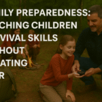 Family Preparedness: Teaching Children Survival Skills Without Creating Fear